


Mont Blanc is a mountain with a unique allure. The ascent to the Monzino Refuge in Val Veny (Aosta Valley)—through the Garda *via ferrata*—is an ideal hike for immersing oneself in the awe-inspiring and thrilling environment of this mountain massif.
Monzino Refuge – Garda Via Ferrata. The beauty of Mont Blanc (Val Veny, Aosta Valley)
Last weekend, I had the chance to discover Val Veny, a valley opening up to the south from Courmayeur, at the foot of Mont Blanc. It was love at first sight. The central part of the valley features an idyllic landscape: the Dora di Veny stream flows along the valley floor, winding through beautiful pastures and lush green meadows interspersed with coniferous forests. We stayed at the Aiguille Noire campsite in our camper van. The site is small but very welcoming and well-organized; we enjoyed the peace and quiet, as well as the cool air—something we’ve been craving like oxygen during this unsettling, scorching summer. Higher up, past the rugged moraine area where the Miage Glacier flows (or rather, *used* to flow), the fairytale plateau of Alpe de la Lex Blanche opens up beneath the Rifugio Elisabetta and the Col de la Seigne. Throughout the valley, the peaks of the Mont Blanc massif loom overhead, featuring the Grandes Jorasses, the instantly recognizable Dent du Géant, the Aiguille Noire, and many other iconic summits.
To start my hike on Saturday, August 1, 2026, I set off directly from the Aiguille Noire campsite so I wouldn't have to move the van (see my track below).
Alternatively, you can save about half an hour of walking by starting from the paid parking lot a few kilometers further along (click here for the location). I had read a lot of information regarding the difficulty and duration of the Ferrata Garda, as well as possible route variations. I must say that not all the information published online was accurate; in this article, I’ll highlight some of my own impressions and offer a few tips.



Click here for the complete slideshow of the excursion
From the parking area, follow the path running along the right bank of the river. If you have taken the valley-floor carriage road, leave it near the Chalet del Miage restaurant and take the dirt track to the right leading toward the river (trails 16 and 18). Shortly after crossing the river via a vehicle bridge, you will find signs directing you to leave the road and take a path to the left that climbs into the woods (still trails 16 and 18). The signpost points toward the Monzino Refuge, indicating a 2.5-hour ascent time (which I consider accurate on average). The path then emerges from the woods (at the 3 km mark on my GPS track) and traverses a vast scree slope crossed by streams flowing down from the Freney Glacier (bridges help cross the streams). After another 300 meters, you reach a major fork: to the right, the path heads toward the start of the Garda Via Ferrata (trail 16); straight ahead, it leads to Lago delle Marmotte and the Luigi Glarey Via Ferrata (trail 18), another possible route up to the Monzino.
And here, I need to make a brief digression.
The Monzino Refuge website states that the Glarey Via Ferrata is easier than the Garda route but recommends ascending it rather than descending, due to the presence of unstable terrain. I had intended to descend via that route, but upon reaching the Monzino, I was advised against it; I was told the path was in poor condition due to a lack of maintenance. Down in the valley, I also found a sign indicating that the trail to Lago delle Marmotte was closed. Consequently, I doubt the route is currently passable, even for the ascent. If you wish to complete the loop by linking the two *via ferratas*, I recommend checking for up-to-date information on the condition of the routes. If you have any updates, feel free to share them in the comments section below the article.
After the fork, turning right brings you to the start of the *Ferrata Garda* in about 10 minutes. The route is essentially divided into three sections interspersed with stretches of trail; the path is consistently very steep and offers little respite.
The first section of the *via ferrata* is quite easy, as the rock face is not very steep. On the descent, I didn't even clip in with my *via ferrata* carabiners at many points, prioritizing speed of movement. Even on the ascent, clipping into the cable isn't strictly necessary—in my opinion—on the less vertical sections, provided you have good experience and sure footing. Above this initial protected section, a long, steep, and rather uneven stretch of trail begins—featuring many switchbacks—that is sure to make you sweat. However, the scenery begins to open up, revealing the cliff face beneath the Freney Glacier, the waterfalls of its rushing streams, and the Aiguille Noire, which gradually comes into clearer view.
At the end of this trail section (according to my GPS track, 4.4 km from the start), the second, significantly more challenging part of the *via ferrata* begins; it ascends the vertical rock face beneath the glacier on the left (south) side.

This section of the *via ferrata* features many vertical stretches requiring effective use of the arms. However, the route is generously equipped with rungs, so there is little need for actual rock climbing or searching for narrow handholds and footholds. The cable is always close at hand and generally well-maintained. Several sections also involve a degree of exposure. From a technical standpoint, however, there are no extreme difficulties for those accustomed to this type of route. The path then resumes, curving southward; at the end of this stretch—at an altitude of approximately 2,400 meters—there are a few final equipped sections, most notably a sub-vertical reddish rock slab where rungs facilitate the passage.

The path then turns north again and—following a route that remains steep, naturally—reaches the saddle between the Aiguille de Chatelet and the Monzino Refuge, which is now clearly visible above you.
A brief aside: from that saddle, you can also follow the trail leading to the Aiguille de Chatelet’s north ridge; a short, somewhat exposed route equipped with fixed aids takes you quickly to the summit cross.
I headed straight for the Refuge, situated at an altitude of 2,590 meters, where I enjoyed a well-earned Gran San Bernardo Weiss beer. After the beer, I took some time to really admire the scenery surrounding the Monzino.
The Aiguille Noire towers above the seracs of the Freney Glacier, possessing an almost hypnotic beauty. It is hard to tear one’s eyes away from its face and summit. Yet, looking to the left, there is an endless succession of other peaks and spires—including Punta Gugliermina, the Aiguille Blanche de Peuterey, and (clouds permitting) the summit of Mont Blanc de Courmayeur. Beneath the latter lie the Freney Pillars, famous for the tragic 1961 ascent involving Italian (led by Bonatti) and French rope teams. Further left lies the spectacular Brouillard Glacier, overlooked by other 4,000-meter peaks. Incidentally, the trail leading up to the Refuge—following the Glarey *via ferrata*—arrives from this direction.
At these altitudes, the glaciers remain fascinating to observe, yet they clearly reveal the devastating effects of human-induced climate change: exposed grey ice—devoid of snow cover—and gaping crevasses everywhere. Below roughly 2,500 meters, the picture is stark; very little remains of the glacial tongues.

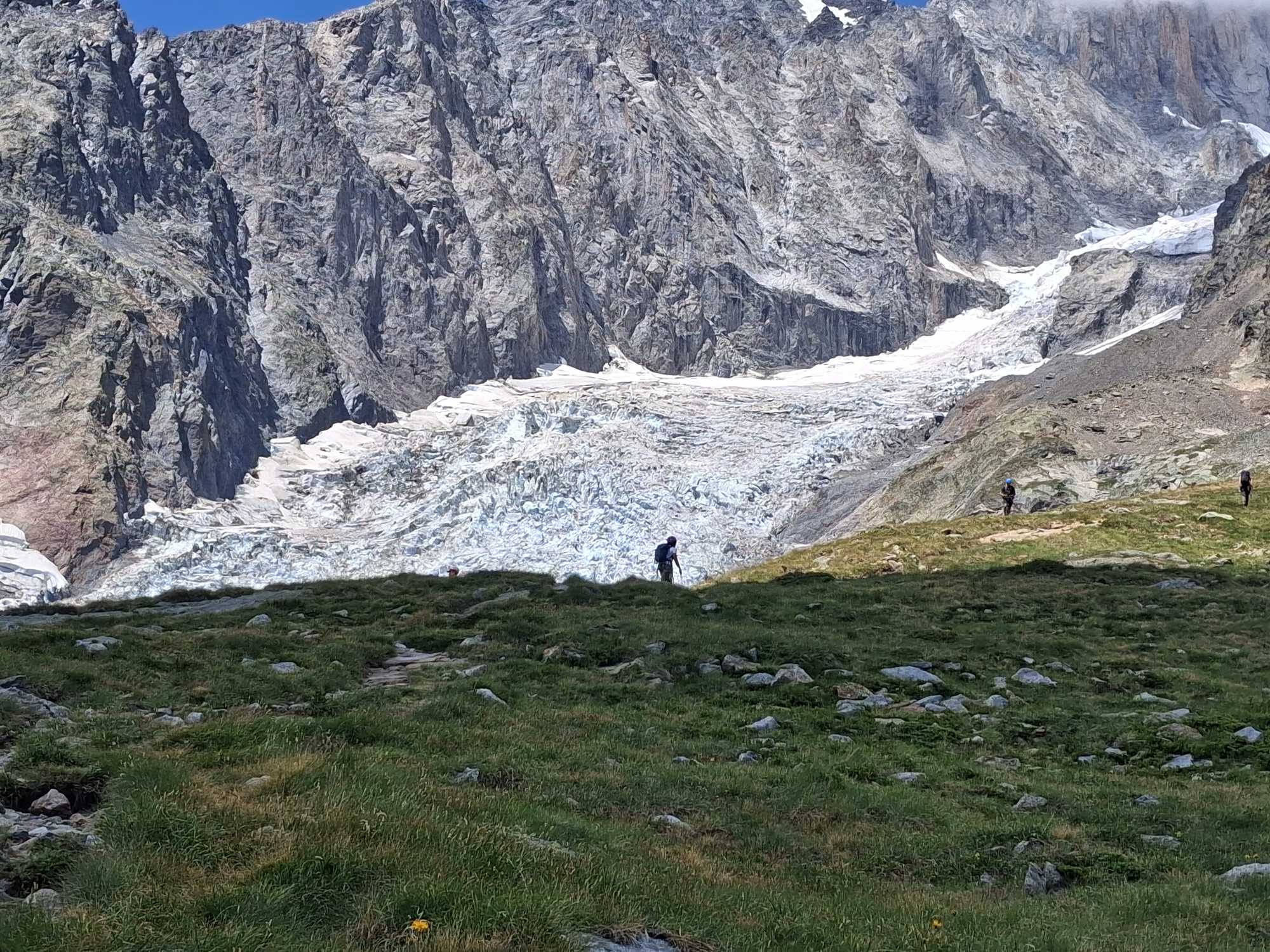
After about an hour of thrilling immersion in this incredible high-altitude setting, I began my descent to the valley—taking, as previously mentioned, the same route I had used on the way up.
The *via ferrata* was not crowded at all, and I encountered very few other hikers on the descent. At certain points, the route splits in two; always keep to the right—whether ascending or descending—to avoid crossing paths with others where there are dual cables.
On the way down, natural footholds and handholds become more apparent along the trickier sections, since you are viewing them from above. Furthermore, at several points, I descended by leaning back against the cable (trusting its hold)—almost like rappelling—to allow my boot soles to maintain optimal friction against the rock.
I completed the *via ferrata* at a leisurely pace in about three hours, and after another half-hour, I returned to the campsite—tired, but happy.
It was—for a change—another memorable day in the mountains...
Ciao, Fabio Muriano
Click here for the complete slideshow of the excursion
Without your Support, Waterwind wouldn't exist. Become our supporter! Listen to this article podcast. Leave a comment on this article below! If you want to advertise with us, read here, or conctact us.