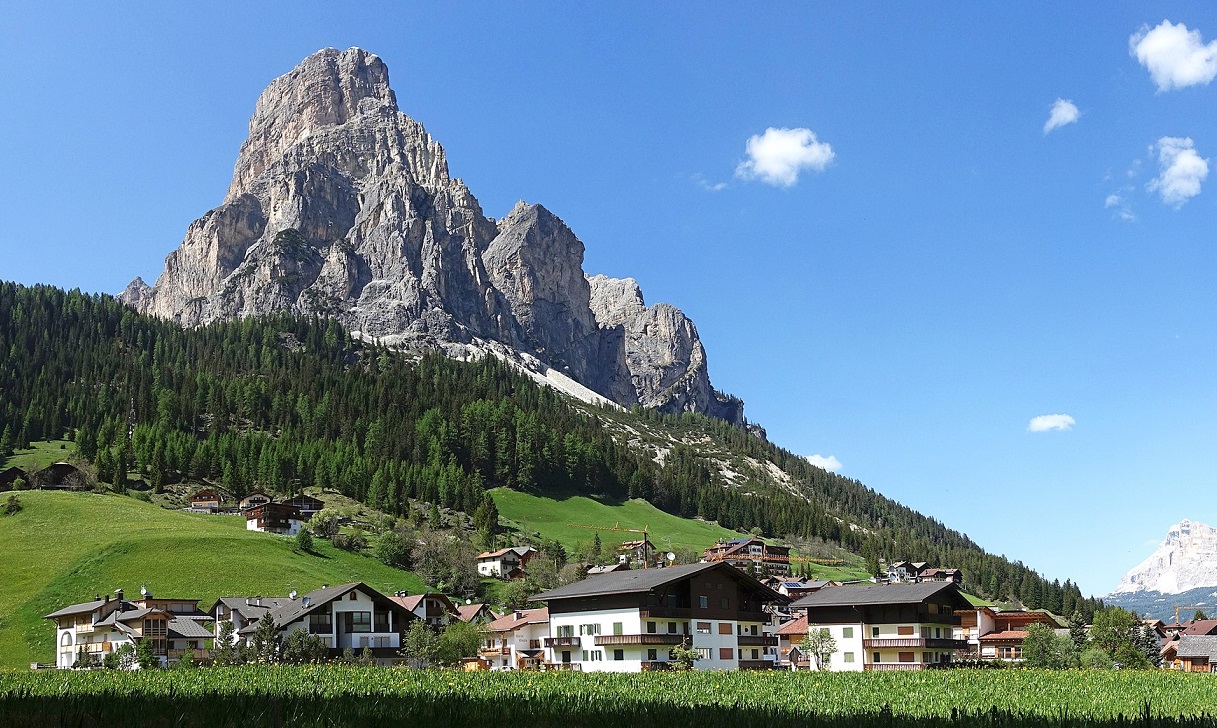
I had been looking at the Sassongher peak for some time, during my family holidays in Badia Valley (Gadertal). Finally, I found a way to climb this peak in the Dolomites, which is relatively easy but offers an exceptional panorama.
Trekking: Sassongher (2.665 m), Badia valley (Gadertal), Dolomites
The Sassongher, seen from Corvara, appears as a rock monolith towering over the valley. In reality, its overall shape isn't that towering; certainly, its top is aerial and extremely panoramic since there are no other high peaks in the nearby. You can climb to the summit starting from Colfosco, possibly facilitating the ascent with the chairlift that takes you to Col Pradat, where the namesake refuge stands; or, you can go up, as I did, starting from La Villa, and more precisely from the top station of the Gardenaccia chairlift. In the latter case, consider that the climb is relatively simple, but a bit long (even if nothing extreme).
For the technical data of my ascent, refer you to the map of my excursion below.

Picture by: Tiia Monto, CC BY-SA 3.0, https://commons.wikimedia.org/w/index.php?curid=79873327
In short, after getting off the chairlift, take one of the two paths that leads to Gardenaccia, in about 1 hour. I took the one that does the northernmost loop, which is a bit steep, and with some rocky steps, but nothing complicated. The Gardenaccia Hut is in a very pleasant position, and is a good refreshment point to consider when returning from your excursion. Click here, for the complete slidegallery of my ascent.
After the Refuge, you must follow path N. 5 up to Forcella Sassongher (forcella = pass), where the path that climbs from Colfosco also arrives. Then, following the path n. 7 you get to the top.
Actually, I came up with a variation. Shortly after Gardenaccia, I abandoned route 5 and continued on route 11, which leads towards the Puez group and the Puez Hut. This path goes around longer, but climbs wide and very comfortably at high altitudes, avoiding the lower part of 5, which, however, is steep and with some tiring rocky steps to overcome uphill. At an altitude of about 2250 meters, then, I returned to the straight path...., improvising a track through meadows, in the upper part of the valley, on the NE side of Para Dai Giai Mount (another possible beautiful peak to reach, also characterized by summit cross, and not to be confused with the more distant summit of Sassongher).
I then took path number 5 just below the gully to the north/north-east of Para Dai Giai, where the path climbs with a serpentine up to a pass. From here a long traverse, on a path that is somewhat exposed at times, cuts across the entire SE slope of Para Dai Giai, until it reaches the Forcella Sassongher. The environment is evocative and solitary (even in August, I haven't met many hikers on this track). Some overhanging walls above our heads raise fears of possible stone falls (on the way back, I continued to keep the helmet on).
From the Forcella del Sassongher, the conditions change. A steep track on debris, a little unstable, and with some exposed points, requires a little attention in the step. You then arrive at the start of the short aided section (less than 100 metres), with passages that are almost never vertical. I put on the via ferrata harness for safety, even if to tell the truth, I used it very little. Evaluate yourself based on your abilities and aptitudes, but be cautious. A last short stretch of path (without any cables) then leads to the beautiful steel summit cross (2,665 m a.s.l., a good two hours from Gardenaccia).
Badia Valley is surrounded by truly beautiful peaks, and the view from Sassongher is truly rewarding. Towards the North East, the entire Dolomitic walls that goes from Sasso della Croce to Piz La Varela, to continue towards Lagazuoi and the Falzarego pass is striking. Below us lies the Pralongià. To the SE stands the Marmolada, queen of the Dolomites, a little wounded, as its glacier is now in worrying conditions. To the south, in front of us, the entire Sella group, with its most famous peaks (Piz Boè, Sass Pordoi, Pisciadù). The Sassolungo/Sassopiatto to the southwest, and then to the west the wonderful panorama of the Puez-Odle group, which culminates in the Sass Rigais.
Just wonderful!
To get down, I followed the path 7, and then all of the 5 up to the Gardenaccia, realizing, in fact, that the latter is a somewhat steep and tiring path for the knees, in the lower part . The wise use of trekking poles has become fundamental for me. I was also good at the Refuge, where I avoided drinking my usual Weissbeer...., which feeds my belly.... (even South Tyrolean gastronomy is "dangerous" from this point of view), and contented myself with a good thirst-quenching raspberry.
Enjoy the trip. Fabio Muriano
If you want to add your thoughts, or tell your experience, you can do so in the comments below.
Click here, for the complete slidegallery of my ascent.
Video of the hiking
Without your Support, Waterwind wouldn't exist. Become our supporter! If you want to advertise with us, read here, or conctact us.


