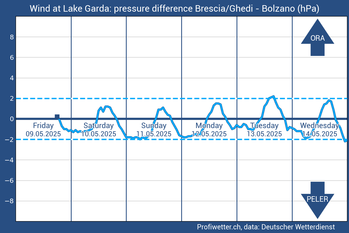
On this page, you can view an important diagram for all water sports practitioners on Lake Garda: the Peler and Ora graph (or diagram).
Weather forecast: the Peler and the Ora Graph
The graph shows the expected pressure difference between Brescia and Bolzano in hPa for the next 5 days. The source of the data is the Deutscher Wetterdienst. A difference of - 2 hPa (i.e. the air pressure in Bolzano is higher than that of the air in Brescia) is the minimum value starting from which the genesis of Peler can occur in the spots of central-northern Lake Garda. The higher this pressure difference, the stronger the Peler intensity will be. However, since it is a thermal wind, other concomitant factors (e.g. southerly currents at medium-low altitudes) can easily disturb the formation of this wind.
A pressure difference of 2 hPa, instead, is the threshold beyond which the genesis of the Ora can occur, the thermal from the south in the spots of the northern part of Lake Garda.
In short, it is a useful piece of information for planning your sessions.
Have a good session.
Lo staff di Waterwind

Without your Support, Waterwind wouldn't exist. Become our supporter!
If you want to advertise with us, read here, or contact us.
Collaborate with us. Read here!
Buy our Gadgets! Visit our YouTube channel!


